Archive for the ‘transportation’ Category
Recommended read: “Walkable City” by Jeff Speck
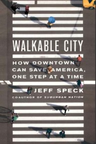
The latest book by renowned city planner Jeff Speck is Walkable City: How Downtown Can Save America, One Step at a Time (2012). This is a follow-up to Suburban Nation, his popular work on sprawl in America’s suburbs.
“It turns out the way we move largely determines the way we live.” (55)
What I really enjoy about Jeff Speck’s writing is that he explains city planning concepts in a way that is universally relatable – to anyone with or without a background in planning, whether a resident of the city or the suburbs. It’s clear his writing is meant to grow mass support for urban living and walkable cities, and though he employs plenty of statistics to make his arguments, he keeps the material from sounding dry or inaccessible.
Speck moved to Washington, DC after leaving his home in South Beach, Miami, and has also lived in the various towns and cities he has helped plan. This means he can draw upon plenty of firsthand experience of what makes a city livable and capable of drawing new residents. (If you live in DC, you’ve likely seen his flatiron-style home at 10th and Florida Avenue NW.) His city planning experience also lends itself to his writing, and he pulls many real-world examples of the advantages of walkability and what makes certain cities so magnetic.
Speck centers the text on his “General Theory of Walkability” which centers on four conditions of what makes a good walk. It must be (1) useful, (2) safe, (3) comfortable, and (4) interesting. From this theory, he then presents ten steps for creating a more walkable city. As a self-proclaimed generalist, he recognizes that to design a city one cannot disregard cars, bicycles, transit, or the other elements at work. Speck makes sure to touch on these points in turn. The result is a book that is tuned into the physical and cultural landscape of cities today, as well as the demographic and geographic shifts currently at play in America. Jeff Speck didn’t write Walkable City for the planners, but for the people who live in these communities.
Jeff Speck’s Twitter feed is @JeffSpeckAICP.
Year 2012 in Cycling
When I first moved to DC, I bought a used Trek mountain bike from a seller on Craigslist for $140. I used it to get from home to school and work and back, riding down from Columbia Heights in the morning and back up through Adams Morgan in the evenings. And knowing nothing of bicycle maintenance at the time, I once let a wheel get so badly out of true that I eventually had to alternate between carrying it and half-lifting, half-rolling it the six blocks to the nearest bike shop.
My housemates and many of my friends also rode to get around – it’s just the most practical mode of transportation within the city – but I can’t recall riding for the pure pleasure of it. Cycling was simply a more reliable option than taking the bus: my commute always took the same time and I didn’t have to wait 40 minutes at night for a bus that never came. (That used to happen pretty often when I worked late shifts at work.) On my mountain bike I was slow, but faster than when I was on foot.
2012 was the first year I rode for more than pure transportation purposes. I bought my first new road bike with a recommendation from my friend, who’s an avid road cyclist. I led a team of a six to ride in the Bike MS charity ride in June, which meant I had to train for distances I had never even imagined riding before: a total of 100 miles over two days. Besides getting food poisoning a couple weeks before the ride and losing a lot of fitness there, the ride went well and everyone on my team finished the ride happy and exhausted. We polished off a couple pizzas and about half a chocolate cake afterwards. By then I also knew to keep my chain clean and lubed and how to change a flat tire, and the function of most bike parts.

I’ll pull just a few numbers about my first year of getting more into cycling. Most of these stats come from Strava, where I’ve recorded maybe 80-90% of my rides this year.
Most Elevation Gain in One Month: 9,910 feet in August. I did some riding in Maryland, rode the Reston Bike Club (Metric) Century, and part of John’s Hoppy 100 ride, which I hope he makes into an annual event. I know people that climb more than this in a single ride, but I’m happy with my progress.
Most Mileage in One Month: 391.2 miles in October. This includes a weekend ride to Harpers Ferry and back, the Seagull Century, and several commutes. It’s also the month I got my Surly, which replaced my road bike and became my do-everything, pleasure-to-ride bike.
Longest Single Ride: 127.1 miles. This was my first brevet, the Flatbread 200k.
Mileage on Capital Bikeshare: Over 150 miles. This number may even be closer to 200 miles, considering I usually don’t record my short Bikeshare trips. It’s a great service to get around town, and I’d say a year-long membership is essential for anyone living in DC.
Total Mileage for 2012: 2,397.3 miles since mid-March. I’m shooting for at least 3,000 miles next year.
Below is a screencap displaying my local ride map for the year, created with Jonathan O’Keeffe’s multiple ride mapping tool. The line thicknesses represent frequency of riding specific routes. Suggestions for where to ride more in 2013? Arlington streets don’t appear to be represented, though I take the Custis Trail quite often.

I’m sure all this riding balances out the beer.
Hains Point 100 for Women and Bikes
What a successful event! The Hains Point 100, a century ridden entirely as loops around Hains Point, was an idea by Megan Jones sprouted a few weeks ago. She decided to make it a fundraising ride for WABA’s Women & Bicycles advocacy program, which will work to support women’s cycling in the DC area.
The Census Bureau reports that women make up only 2,985 of the 9,300 DC residents who commute by bicycle. To put it another way, there are more than twice as many male cyclists than female cyclists. WABA’s new program intends to address this gender gap in cycling and get more women on bikes. Megan noted this morning that the ratio of women to men at the Hains Point 100 ride was very similar, but that it was important for everyone to help in this effort.

Lots of great local sponsors – and one not-so-local sponsor, New Belgium Brewing – pitched in to provide snacks, prizes for riders, and donations. Plenty of people brought food (especially baked goods) to keep the picnic table full as well. Hains Point worked as a great location for this kind of ride since it’s a short 3-mile loop and riders could take a break or grab snacks when they came back to the meeting point.
I rode a few laps and got to see lots of DC area cycling folks out today on a beautiful winter day. Megan (and others) successfully rode over 100 miles each, and raised a lot of money to support the cause by putting on this event.
You can donate here: WABA’s Women & Bikes Program.
Highlights from a long weekend in Georgia
Spent the last weekend and some change in Georgia visiting a couple friends who have moved out there recently. I’d never before been to Atlanta, so it was a good chance to explore what lay beyond the reaches of the Hartsfield–Jackson Atlanta International Airport (ATL) – the world’s busiest airport.
High Museum of Art in Midtown

The High Museum is the largest art museum in the Southeast, housing a huge and varied collection. It is part of the Woodruff Arts complex, which includes a theatre, symphony hall, and restaurant. In their own words, the High’s collection includes “an extensive anthology of 19th- and 20th-century American and decorative art; significant holdings of European paintings; a growing collection of African American art; and burgeoning collections of modern and contemporary art, photography and African art.”
The museum also has a focus on folk art, with many pieces pushing the bounds of art brut (outsider art). It was fascinating to see the work of self-taught artists working in a variety of mediums, including found materials. One of these artists was the Reverend Howard Finster, whose outdoor museum Paradise Garden is a strange and exaggerated celebration of god. Finster was a Baptist minister who heard a voice one day telling him to devote his life to making religious art. The High Museum owns part of the original Paradise Garden installation, and dedicates a room to his work.

We saw furniture designed by Frank Lloyd Wright, as well as the famous Red Blue Chair by Gerrit Rietveld. I tend towards the more modern and contemporary works, and my favorite exhibits at the High included Anish Kapoor’s concave dish of mirrors (you can play with light and sound) and the special exhibit “Fast Forward: Modern Moments 1913-2013”. One strange rule was that for the special exhibit we couldn’t take photos with dedicated cameras, but cell phone camera photos were allowed – anyone know why that would be the case?
As with many other institutions in the city, Coca-Cola is the largest benefactor of the museum. The Coca-Cola Company headquarters is in Atlanta, as well as the World of Coca Cola – which we didn’t visit.
The High is located on Peachtree Street, but so is supposedly everything else in Atlanta. The name “Peachtree” is a popular street name here, which makes things just a bit confusing for outsiders. There are even places where streets of the same name cross each other. I’ll meet you at the intersection of Peachtree and Peachtree.

It’s easy to while away half a day exploring the High Museum, and that we did.
Georgia Aquarium
We went downtown to visit the impressive Georgia Aquarium on Monday, since it would be less crowded than on the weekend. This aquarium is notable for its size – the largest in the world – and the number of species it holds. Especially interesting is that is the only place you can find whale sharks outside of Asia; the Georgia Aquarium houses four of these strange and beautiful creatures. There are several enormous tanks in the Ocean Voyager gallery, the most impressive of which you can walk through in a glass tunnel.

Getting Around
Atlanta is a city built for driving, with highways cutting straight into the city and a major spaghetti junction that’s often referenced on the traffic report. Luckily, we managed to avoid driving during rush hour, which I’ve heard is horrendous (though probably not much worse than Tysons Corner traffic, I assume). Though walking within certain areas in the city is manageable, it can be tough to walk from one neighborhood to another, due in part to the sprawl of the city and in part to the highways that divide Atlanta’s urban areas. I did see a few bike lanes, but only a handful of cyclists.
However, there is a limited public transportation system in Atlanta, named MARTA (Metropolitan Atlanta Rapid Transit Authority). MARTA consists of four subway lines, but they only run in two lines within the city: east-west or north-south – with stations spread relatively far apart. And the buses run about every 40 minutes, making it tough to rely on for quick trips.
Despite these major walkability issues, Atlanta has a lot of culture and history, strong economic drive, and is well worth exploring. It started as an important southern city at the crossroads of major rail lines and has a proven record of rebirth through times of hardship. I’m hoping to return one day to learn more, catch up with friends, and explore the many parks of Atlanta.

The Dawn of Transit-Oriented Development in Tysons Corner
Past and Current Tysons
Tysons Corner today is centered on its two malls and its fleet of office buildings, along with hotels and additional retail. It is considered part of the technology business corridor that stretches west to Reston, as Tysons is home to many large tech companies – some of whom where around since they witnessed the rise of the Internet Age. The economic core of Fairfax County, Tysons Corner is a huge business district drawing in over 100,000 workers on a typical weekday.
 The immense Tysons Corner Center mall opened in 1968, and the more upscale Tysons Galleria mall (commonly called Tysons 2) opened nearby twenty years later. Tysons 2 is not attached to Tysons Corner Center mall; though it is possible to walk between the two malls, it’s not recommended because there are few sidewalks or crosswalks. The crosswalks that exist are by no means consistent – right now you can’t make the walk without having to scamper across at least a couple of lanes while watching for car traffic. There are many curved turn lanes leading to mall entrances that prevent cars from needing to slow down much, while exposing people on foot to more risk when crossing. In the original iteration of Tysons Corner, pedestrian access has typically been an oversight.
Being a very popular shopping destination, the Tysons Corner Center mall experiences a mind-numbing amount of traffic during the holiday season. I currently work in the area, and many of my coworkers’ commutes take them twice as long in December – and 30 minutes to an hour of that is just sitting in traffic leaving the mall. Metrobuses trying to get into and out of the mall area also take significantly longer, stretching the usual 15 minute ride to the West Falls Church Metro to an hour or longer.
And despite the immense draw of Tysons Corner for business and shopping, it lacks residents. There are very few people living here, very few amenities to attract more to stay past closing time, and very few ways to get around without a car in the evenings.
Metro Connections
Tysons Corner in the 1950s was originally planned with accessibility by private automobile in mind, and is only now shifting to more transit-oriented development. Right now, the best way to reach Tysons Corner by public transit is using bus lines that run through the area from the West Falls Church Metro station. The 28A, 28X, and 28T all make a stop at the mall and run on a frequent schedule during rush hour. However, the future Metro Silver Line will bridge this connection, making parts of Tysons Corner reachable without the need to transfer to a bus.

The current plan for the Dulles Corridor Metrorail Project (dubbed the “Silver Line”) will construct Metrorail stations in two phases along the Dulles Corridor in Loudoun, Fairfax, and Arlington counties. Phase 1, currently under construction, is set to connect the currently existing West Falls Church Metro station to the future stations in Tysons Corner and at Wiehle Avenue in Reston – total of five new stations. These should open in 2013 if construction stays on schedule. Phase 2 will later add six additional stations, connecting Reston to Herndon, the Dulles Airport (IAD), and Ashburn.
For Tysons Corner, Metrorail access will be a huge boon. Mass transit will allow more people to come without a car and will spur the growth of new types of businesses around these stations. Adding Metrorail connections also helps accommodate the heavy seasonal traffic to Tysons without further congesting the nearby area.

The Comprehensive Plan
So, there’s a need to build stronger transit links, design the area to be more pedestrian- and bicycle-friendly, add residential and retail development to attract people to live in Tysons, and make it a place of activity around the clock. The Comprehensive Plan approved in 2010 aims to just that. It envisions 100,000 residents living in Tysons Corner and 200,000 jobs by the year 2050. Malcolm Kenton of Greater Greater Washington summarizes the Tysons master plan:
The new Tysons, in addition to very dense evenly mixed-use development near the three Metro stations, will feature an urban circulator, which could take the form of a streetcar or a rapid bus line. An expanded network of on-road bike lanes and off-road bicycle & pedestrian paths, as well as bike parking minimums, will help increase non-auto modes’ share of daily commuters from just three percent today to 36 percent in 2030.
Not including the construction of Silver Line and HOT lanes, this will cost $1.698 billion over 20 years. This will eventually decrease total automobile traffic to the area as other modes of transportation become more convenient. A liveable and walkable place would be a vast improvement on what is currently Tysons Corner. I’m eager to see these plans play out over the coming years, aligning the ‘new’ Tysons Corner with the ideals of transit-oriented development.
For further reading, see…
Transforming Tysons Corner: A High-Stakes Suburban Retrofit on DC Streetsblog
Tysons highlighted as global example for smart growth on Greater Greater Washington
Refocus the Transportation Network on Fairfax County’s website
Internet Alley: High Technology in Tysons Corner, 1945-2005 by Paul Ceruzzi
Transportation and Urbanism News
A few links to interesting transportation and urbanism news from the past couple of days:
- Greater Greater Washington, “Plan your next bike trip with BikePlanner.org.”
Big news for those in Washington, DC who get around by bicycle – BikePlanner.org, just launched, is a great new tool from OpenPlans and BikeArlington that will help you plan your journey, whether you’re using your own bike or a Capital Bikeshare bike. You can choose whether flatness, speed, or safety (bike-friendliness) are your primary concerns when routing your trip by moving the crosshairs within the triangle at the bottom-left. - Digital Urban, “Using Oyster Card journeys to understand how, why and where we travel in London.”
The versatile Oyster Card is a public transportation card with an RFID that allows users to travel using the London Underground, public buses, river buses, trams, and other rail services. As detailed in the linked video, the Oyster Card dataset has allowed researchers to analyze travel patterns within London. - TheWashCycle, “Making the Anacostia Metro more bike friendly.”
It’s always great to hear more plans for the bicycle network in Anacostia. Anacostia, though quite hilly in places, has a growing cyclist community. These proposed ideas will help grow the number of multi-modal trips people make in the area. (On that note, having a Bikeshare membership has greatly increased the number of Metro to bike journeys I make.)
Bike to Work this Friday!
Bike to Work Day is this Friday! There will be pit stops all over DC and beyond with giveaways, food, and drink for anyone who is riding into work. A few of them are even hosting pit stops during the evening commute.
 For experienced riders and frequent commuters, be courteous to your fellow riders – many will be attempting to ride into work for the first time. We have to encourage bicycle commuting by making it fun and as stress-free as possible for everyone. Yes, the trails and bike lanes will be more crowded than usual, but it’s Friday. Take it easy.
First time riders, make sure you map out your route beforehand. I often use Google Maps’ bicycling directions but your coworkers may have some suggested routes too. Bicycle maps from the Washington Area Bicyclist Association (WABA) are also available here. And don’t be afraid to ask for help if you’re lost. Many cyclists will stop for you and get you back on your way.
To stay safe on the road or trails, be predictable. Signal your turns and remember to also look behind you before passing someone.
While it may be too late for the free t-shirts, go ahead and register at the Bike to Work Day Metro DC website. This will help ensure a more accurate count of riders and help for planning purposes.
Finally, it’ll be in the 70s this Friday. Perfect cycling weather – go ride!
Cycling and Second Week of Bikeshare
My second week of using Capital Bikeshare was good – I put a bit more mileage on than the last week. I rode 17 miles on the Bikeshare bicycles and about 15 miles on my own bike, but I’m looking to increase my time riding because I’m in training for the Bike MS charity ride in June. I set my goal for Bike MS at 55 miles on Saturday and 50 miles on Sunday, which is more than I’ve ever done on any given day. It’ll be a good challenge for me and I plan to push myself to go on longer rides leading up to the event.
I’m lucky to have a very knowledgeable friend teaching me the ins and outs of road cycling, and I’ve also been learning about bike maintenance and repair (“wrenching”) by just reading and practicing on my own. It’s exciting diving into this new world – though I’ve had a bicycle since I was a child, I never knew much about upkeep or riding position and didn’t think much of it. My boyfriend tells me the bicycle is a simple machine, and really, it is. Putting a little time into learning about how to fix up a bicycle on your own pays off.

I stopped in at the Velocity Bicycle Cooperative in Del Ray, Alexandria last week and I think it’ll be a great space for the neighborhood. They offer shop space for you to work on your bike using their tools, for a small donation. There are also volunteers on-hand to assist, though you are expected to work on your own bicycle. It’s not near enough to me that I could see myself going regularly, but there’s a similar co-op in DC called The Bike House. The Bike House is now at the Annie’s Ace hardware store in Petworth on Saturdays, which is a new hardware store run by very helpful people. And once the Bloomingdale Farmers Market is back in season, The Bike House will be there on Sundays. I’m looking forward to checking that out. In the meantime, lots of riding!
First Week Using Capital Bikeshare
Recently I signed up for a Capital Bikeshare membership to replace one of the bus rides on my commute. Before becoming a member I had only used Bikeshare once, to get home from a friend’s party in the Waterfront area. Here’s my first week using Capital Bikeshare (CaBi):
 Saturday. Rode to the Orange line and transferred onto Metro to go to lunch out in Virginia. The bike’s heavy so it felt like more of a workout than when I ride my own bike. It’s also very upright. I made the mistake of not confirming the location of a Bikeshare station before heading out, but managed to find a station by asking a fellow CaBi rider. Docked a couple blocks from the McPherson Square Metro station, where there was some construction going on. Nice weekend morning ride.
Sunday. Didn’t Bikeshare – just rode my own bike around all day. But I did notice that there’s a CaBi station near my friend’s house, which is way up 14th Street. The pace of expansion is pretty sweet, with several new stations planned in Arlington, and some stations on the National Mall!
Monday. Rode to the Orange line again since I work in Tysons Corner and I’m trying to use Bikeshare to regularly replace one leg of my commute. I saw a neighbor leaving for work from the same station. Also, I downloaded the Spotcycle app for finding CaBi stations on the go. The UI is a bit wonky but it’s vastly more useful on a smartphone than the station map on the website, which isn’t mobile-friendly.
Tuesday. Morning ride had the benefit of pleasant weather, though it was warmer than I thought and kept shedding outerwear along the way. Shed scarf as I wait at a stoplight, and so on. Evening ride was non-existent. I was a bit late getting back into the city because I went to happy hour with coworkers and all the docks at my two nearest home stations were full (checked on the Spotcycle app). Walked back from the Metro, but by the time I got there it appeared that a bike-shuffling truck had been by because there were now 4 empty docks.
Wednesday. Morning ride was great – ideal weather, no jacket riding, few cars downtown around the time I left. In the evening I ran a bunch of errands, which was improved by being able to bike between several points. The stations are, at least for me, conveniently placed. Capital Bikeshare even crowdsources suggestions for new locations here: Crowdsourcing Map. A lot of people must have been hanging out in Dupont Circle (or maybe a lot of members live around there?) because the dock was full at the Massachusetts Ave & Dupont Circle station and a couple others on CaBi bikes were waiting for a docking spot to open. After errands I rode home from Dupont with no issues.
Thursday. Again, superb weather. Just cool enough around 7:30am that I wasn’t feeling too warm by the time I got on the Metro. Also discovered one of the best features of Bikeshare – the Rental Statistics on your member page! See total distance traveled, calories burned, CO2 saved, time spent riding… perfect for any data geek like me. Rode back without a hitch after going out with friends.
Friday. Rode a little further in the morning, though it was grey and (relatively) chilly out – saves me a couple of stops on the Metro for not much more effort. The ride back almost didn’t happen. The Spotcycle app told me that there were no docks open at either of my home stations, but I took the chance and rode to my nearest station… full. Then I biked over to the next-closest and there was one spot open!
Week 1 Statistics – or really, 6 days –
- Total Distance: 14.02 miles
- Total Calories Burned: 602.86 calories
- Total CO2 Saved: 9.52 lbs.
- Total Duration (last 200 trips): 2 hours, 52 minutes, 43 seconds
Not bad for what would have been bus rides instead.
Here’s another cyclist’s story of how bikeshare was his ‘gateway drug’ into commuting by bicycle. And, it’s faster than any other mode of transportation within the city.
Selection of Geo-Projects
Had a great time at last night’s GeoDC meetup. Here’s a quick list of some of the cool projects at top of mind this morning, mostly to get my thoughts down in one place.
- Map Kibera and its empowerment of people living in Nairobi’s informal settlements. And on that note, next month‘s GeoDC topic is slum mapping!
- The Pacific Northwest and the ‘Last Settler Syndrome’ – one always wishes s/he were the last to discover the beauty of a place, and to keep it uncrowded.
- It’s essential to remember the user experience when creating maps, whether static or interactive. GIS developer AJ Ashton of Development Seed walked through some of the choices a designer makes in creating intuitive, easy-navigable maps.
- Andy Chosak of the Mobility Lab discussed transit spider maps, such as this spider map of the H Street Corridor and its nearby transit lines by Peter Dunn. It’s modeled after the spider maps used in London (example below). Spider maps are a great way to display these sorts of systems because they show all the modes of public transportation branching out from a single area, making it easy for a

